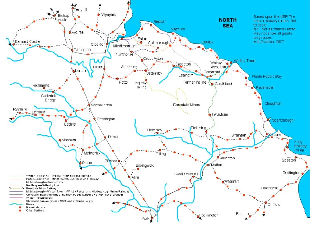
My last journey took me through Loftus, Grinkle and Staithes. You can catch up on that journey here, or Part 1 of my journey here. One week later I continued south eastward, visiting the sites of Hinderwell and Kettleness railway stations.

Staithes
I started where I left off the previous week, at Staithes railway station. The trackbed of the Middlesbrough to Scarborough railway has been overbuilt by a small industrial estate, but the abutments of a demolished underbridge can be seen at the back of the estate.

You’ll notice that the bridge was only wide enough for one track. Almost the entire route of the line was single-track, but most of the stations contained passing loops to enable trains to pass each other.
Towards Hinderwell village
The route now heads towards Hinderwell, the site of our next forgotten station. The track crossed the A174 road on a level crossing, and swept south of the village. According to my Ordnance Survey map, I should have been able to pick up the track bed here by following this waymarked public footpath.
[INSERT PHOTO: PUBLIC FOOTPATH TO HINDERWELL]

However, due to poor public footpath waymarking and flooding of paths due to recent heavy rainfall, it wasn’t possible. I made four separate attempts to access the track bed, but each path turned out to be a dead end, and I had to access the village by road.
A prosperous settlement
Like its neighbour Loftus, Hinderwell enjoyed a period of prosperity due to ironstone mining for several decades either side of the turn of the 20th century, and it contains many fine townhouses. Here are two of them.


In the 1920s, at the start of the motoring age, North Riding of York County Council installed a series of mileposts along the coast road. They are minor works of art. This one is embedded into a wall, and it’s Grade II listed.

The railway station, open from 1883 until 1958. was in the east of the village. An industrial estate has been built on the site, and there are few clues that there was ever a station here at all. This track MAY be part of the track bed of the railway, but the station building is long gone.

The local HM Coastguard headquarters is built on the site of Hinderwell railway station

Runswick Bank Top
The line passed close to Runswick Bay, but there was never a railway station here. It was a tiny fishing hamlet when the railway was built, and would never have generated enough traffic to warrant a station, but the North Eastern Railway later marketed nearby Hinderwell as ‘Hinderwell for Runswick Bay’. After leaving Hinderwell, the line re-crossed the A174 on another level crossing, the remains of which can be seen here

:
This section of the track bed is private land now but, after following the road for a short time, I was able to take another public footpath to get back towards it. I exited the public footpath on to Runswick Lane. The path was flooded next to the style, but I had no choice but to wade through the muddy water.

Also, I had crossed the track bed of the railway without realizing it. I made my way to Runswick Bank Top, then headed back towards where the track crossed Ellerby Lane on an overbridge. The course of the railway can be detected by this line of trees on either side of the road, but I was unable to find an access point and returned to Runswick Bank Top.

Runswick Bay
I now had no alternative but to reach the next railway station, Kettleness, not via an almost perfectly level track bed, but via Runswick Bay beach and the Cleveland Way path. The road descends 85 metres from the bank top to the beach at a gradient of 33%, and the older version was even steeper.


Runswick Bay is a beautiful village, with sandstone cliffs overhanging the village to the north

but the geology of the bay is complex, and sandstone cliffs soon give way to boulder clay, and shale interspersed with seams of ironstone.


Erratics
The beach is littered with boulders washed out of the clay. The clay is a terminal moraine, a dumping ground for materials dragged across the country by glaciers during the recent ice ages. Geologists call these boulders ‘erratics’. This is a piece of Cleveland Ironstone, about 200 million years old, from the local Jurassic sedimentary strata.

But the clay also contains rocks from further afield. This is a piece of the eponymous ‘Shap Granite’ from Cumbria, an igneous rock about 400 million years old.

The Cleveland Way
The Cleveland Way exits Runswick Bay Beach at Hob Holes, an ascent of 90 metres towards Kettleness. The path follows a beck, but recent extreme weather has destroyed the first 200 metres of the path. I had no alternative but to walk alongside the beck, crossing it on several occasions, a difficult and dangerous walk.

A footbridge finally takes you away from the ravine towards a series of steps

‘Let me tell you about the 39 steps, Mr Hannay’, ‘Okay, then, Mr Missing Finger’,’Nah, I’m only playing, there are more than 39 steps, probably about 200’.

Kettleness
I finally emerged on to the cliff top, and found this welcome bench

But there is a great view back towards Runswick Bay from here.

Somebody has kindly provided a defibrillator a few hundred metres further along the way. They obviously know their customer base.
I made my way about 2 km along the cliff top to Kettleness railway station. The station opened in 1883 and closed in 1958. The station building at Kettleness was identical to many of the other stations on the Middlesbrough to Scarborough railway, many of them too large for the small communities that they served.

This was the first time that I had been able to access the track bed that day, despite numerous attempts.

I hadn’t visited Kettleness station since staying for a few nights with the 3rd South Bank cub scouts in July 1971. This was the main bedroom, where I slept, and there are still bunk beds in there now.


CLICK HERE TO DONATE TO OUR CROWDFUNDER
HELP US BECOME STRONGER SO THAT WE CAN CONTINUE TO DELIVER POWERFUL CITIZEN JOURNALISM!